CITY
|
|
[as of 2010]
Location: 4 946 km. east of Moscow, in the Irkutsk Region, 613 km. north of Irkutsk.
Founded: 1954 (a status of the city since: 1955)
Population: 249 700 (2010)
All-time maximum population: 277 600 (2000)
The city emerged upon the construction of the Bratskaya damn and hydroelectric plant. The city consists of a couple of spread out residential developments and villages, located at considerable distances from one another.
|
|
NETWORK
DESCRIPTION
|
|
[2010]
Trolleybuses operate within one residential development only – in the Tsentralniy Zhilrayon (the Central Residential Development), also known as Novobratsk (the New Bratsk). Upon the initial construction, the trolleybus system’s primary function was meant to transport workers to the Bratskiy Lumber Industrial Complex (BLPK) located 3 km. south of the residential development. As city’s economic priorities evolved, the system’s primary objective shifted toward serving the inner city.
|
|
HISTORY
|
|
[2010]
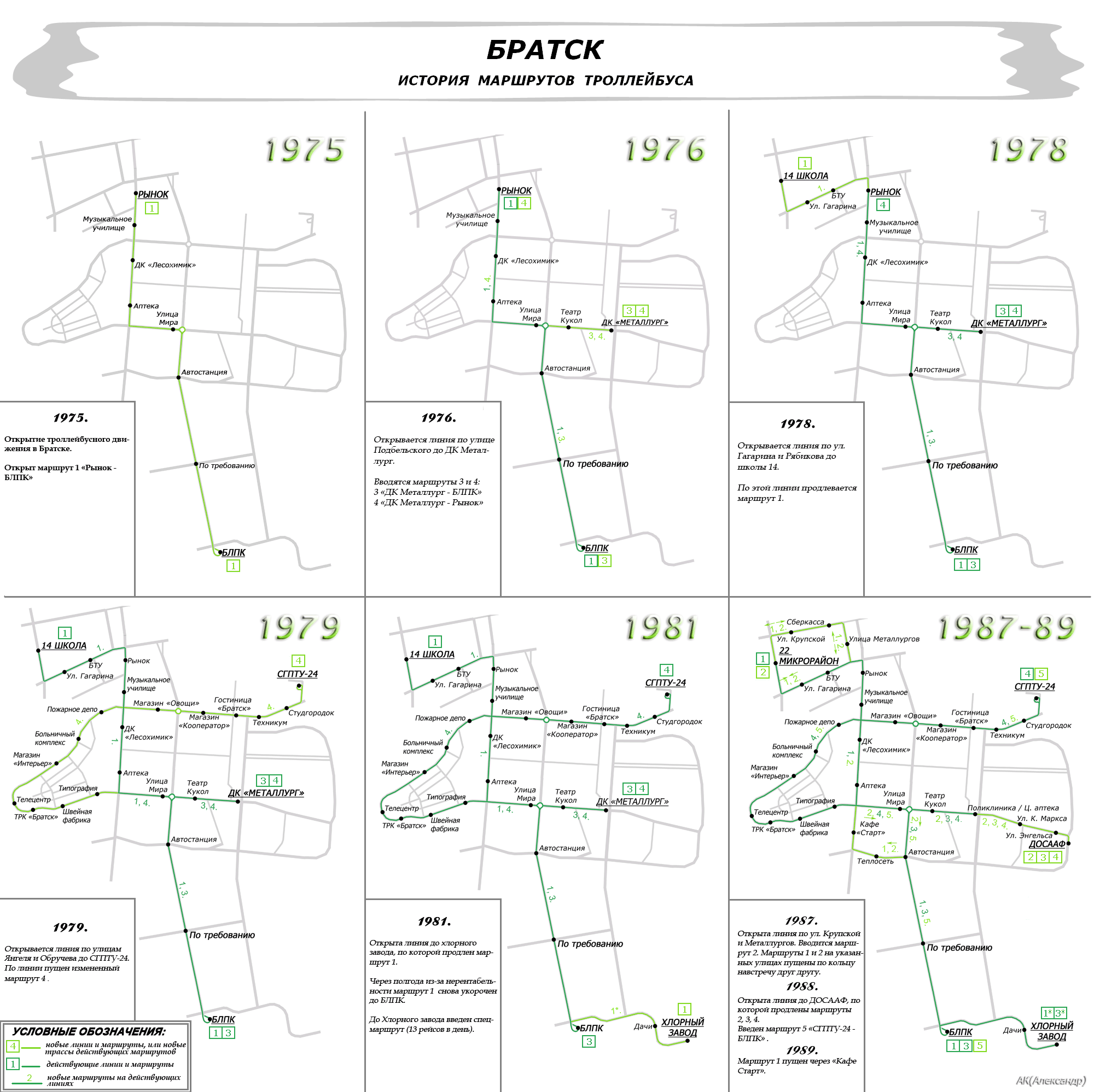
Maps depicting the history of the network development by AK (Aleskandr):

|
|
OVERHEAD
|
|
[2010]
The overhead length: 44,1 km.
|
|
OPERATION
|
|
[2010]
A table with headways and rolling stock usage:

Route 1y is a non-peak hour shirt-turn version of route 1. Routes 1x and 3x are chartered services, operated on request by the Khlorniy Zavod (the Chlorine Factory).
Trolleybus service is highly reliable and predictable.
|
|
ROLLING
STOCK
|
|
BACK
|
|
|
Использование размещённых здесь материалов для публичного показа возможно только с разрешения авторов.
Usage of material found herein for public display is possible with authors' permission only.
|
|