
MetroLink - Downtown to Forest Park
[
World
]
[
USA
]
[
St. Louis
]
[
Facts
]
[
1
]
[
2
]
[
3
]
[
4
]
[
5
]
[
6
]
|
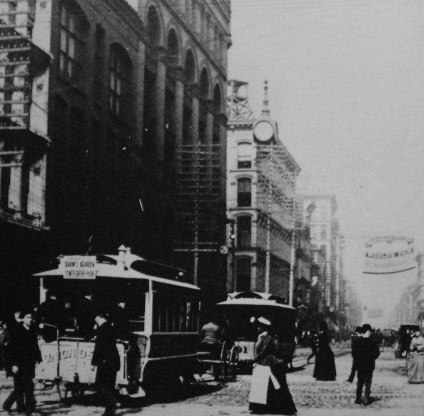
St. Louis in the beginning of the XXth century. |
|
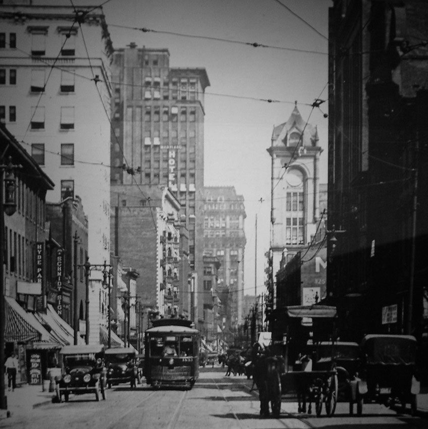
St. Louis in the 1920s. |
|
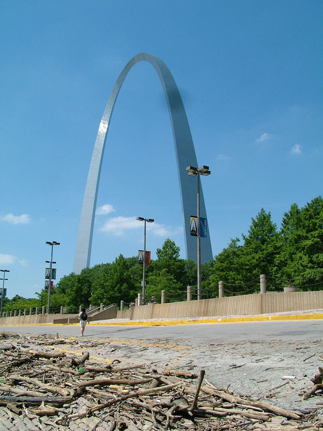
1-01. The famous St. Louis landmark - the Gateway Arch. (19-June-2005, YM) |
|
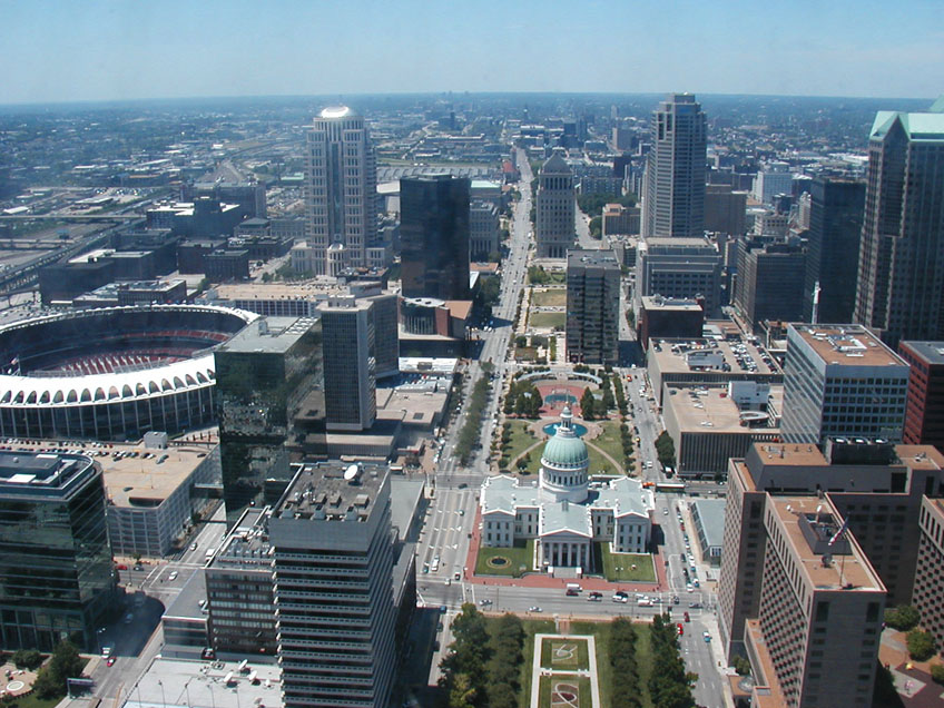
1-01. The view of downtown from the top of the Gateway Arch. Market St corridor is leading directly west. The light rail line is in the tunnel, which goes north - south under 8th St, beyond the park with fountains (Kiener Plaza) in this photo. The line then turns westward and follows the I-64's corridor to the left, then curves back toward Market St as it approaches the Union Station (marked by the tower 12 blocks west up Market St). (13-July-2003, Mike Glikin) |
|
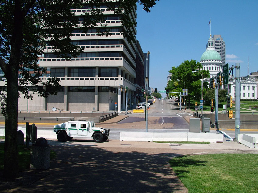
1-01. America gone nuts: an armored Humvee belonging to the National Park Service and fortifications guarding approaches to the Gateway Arch. Despite this locally displayed paranoia and idiocy, things are reasonable when it comes to public transportation. Photography is explicitly ignored by MetroLink staff, which could probably pass for 'welcomed'. It is unambiguously ignored by security personnel, which hints an existence of some special system-wide tolerant policy regarding photographers. This generates a long-forgotten comfy feeling, allowing for worry-free railfanning. (19-June-2005, YM) |
|
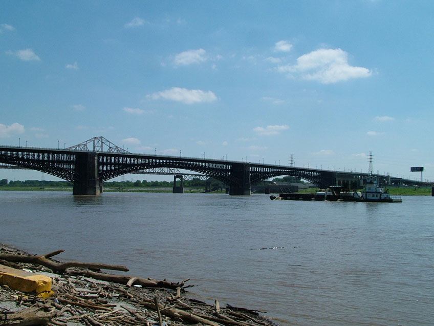
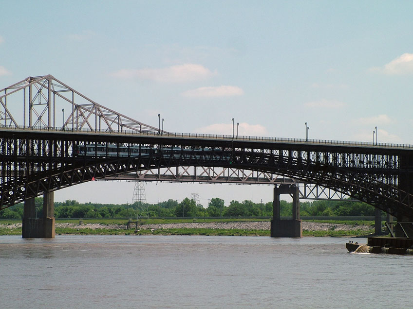
1-02. The light rail line crosses from St. Louis, Missouri into East St. Louis, Illinois via the Eads Bridge over the Mississippi River. (19-June-2005, YM) |
|
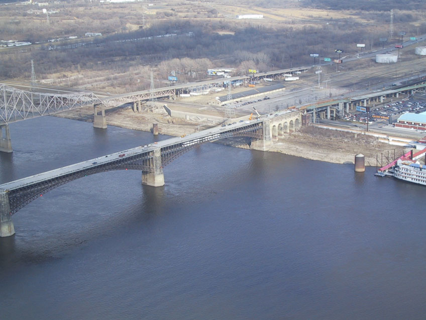
1-02. The view of the Eads Bridge from the Gateway Arch. The eastbound Light Rail Train is visible at the lower level. The East Riverfront Station in East St. Louis is at the eastern end of the bridge. (10-Feb-2003, Stefan Mashkewich) |
|
1-02. The line utilizes the lower level of the Eads Bridge. The upper level is closed for traffic. (19-June-2003, YM) |
|
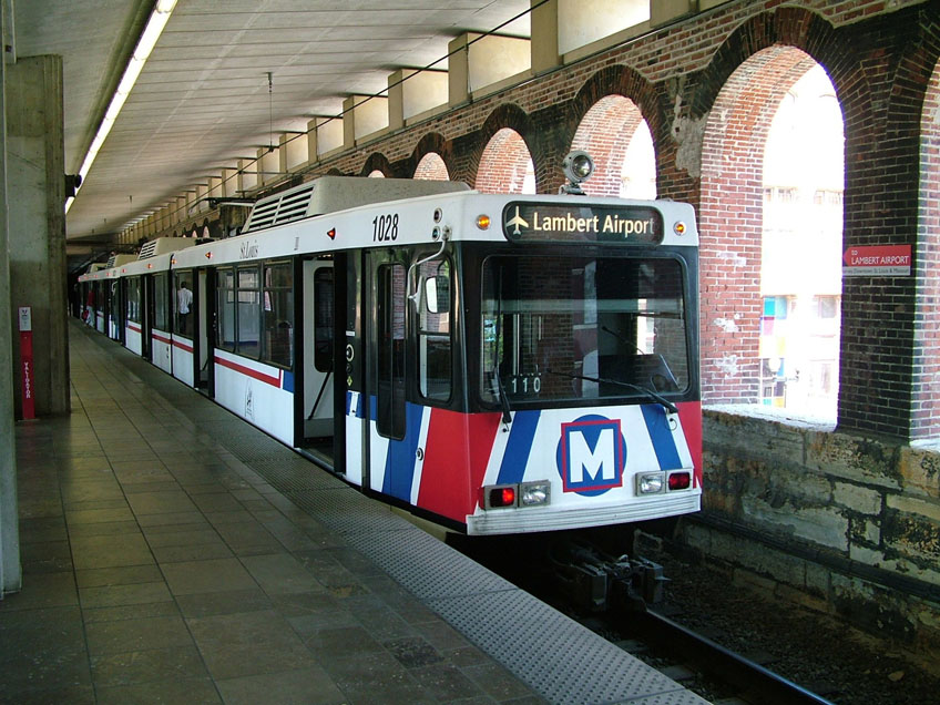
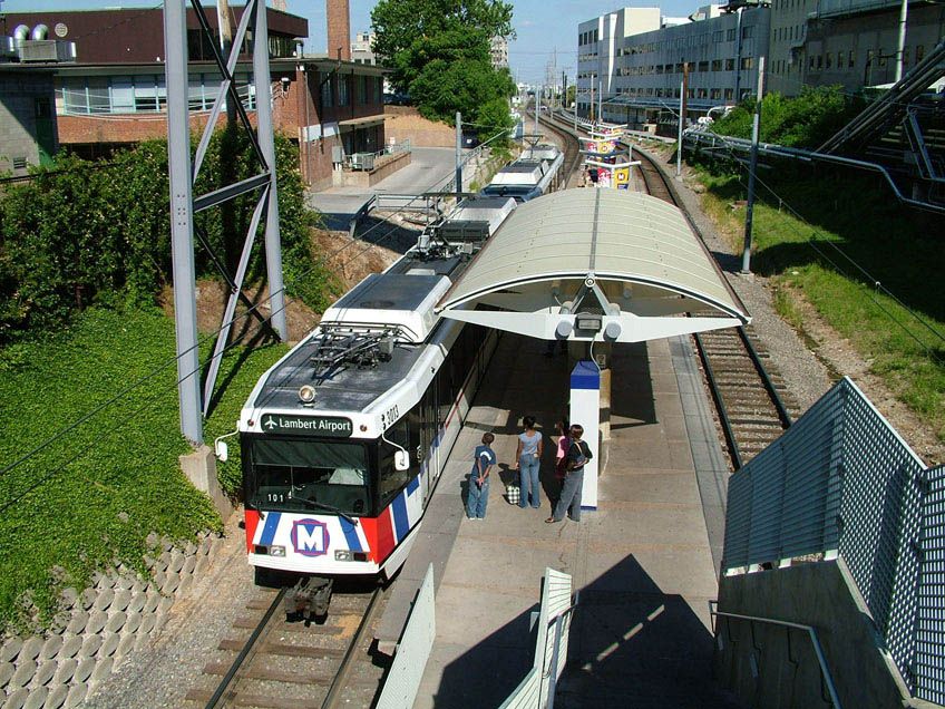
1-03. Lambert Airport-bound train at the Arch - Laclede's Landing Station outside the east mouth of the downtown St. Louis tunnel. The station is located inside the arches formed by the Eads Bridge, on the western side of the bridge. (19-June-2005, YM) |
|
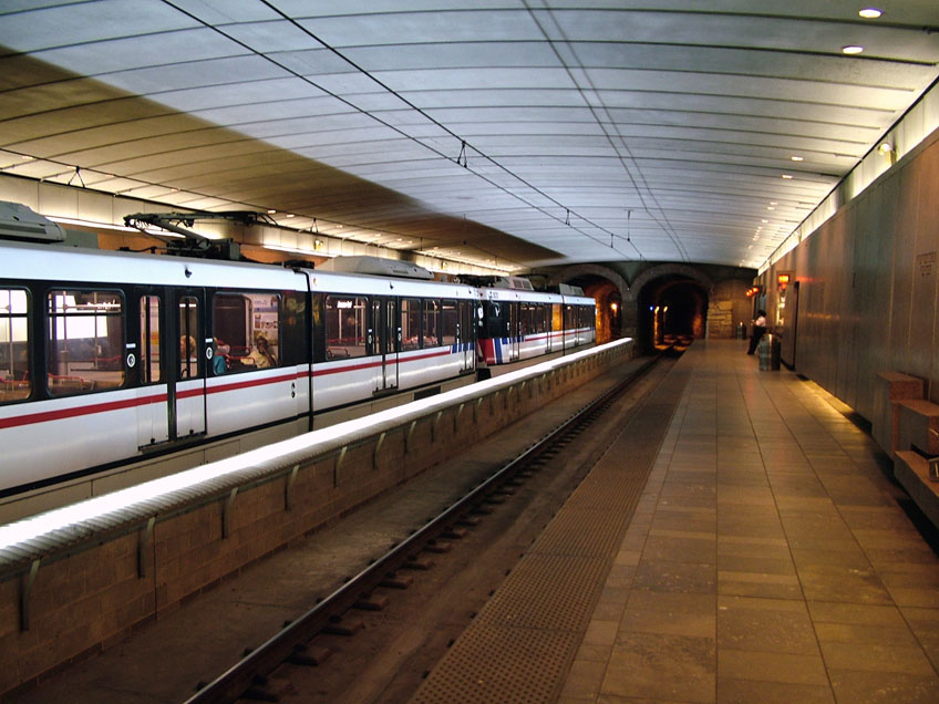
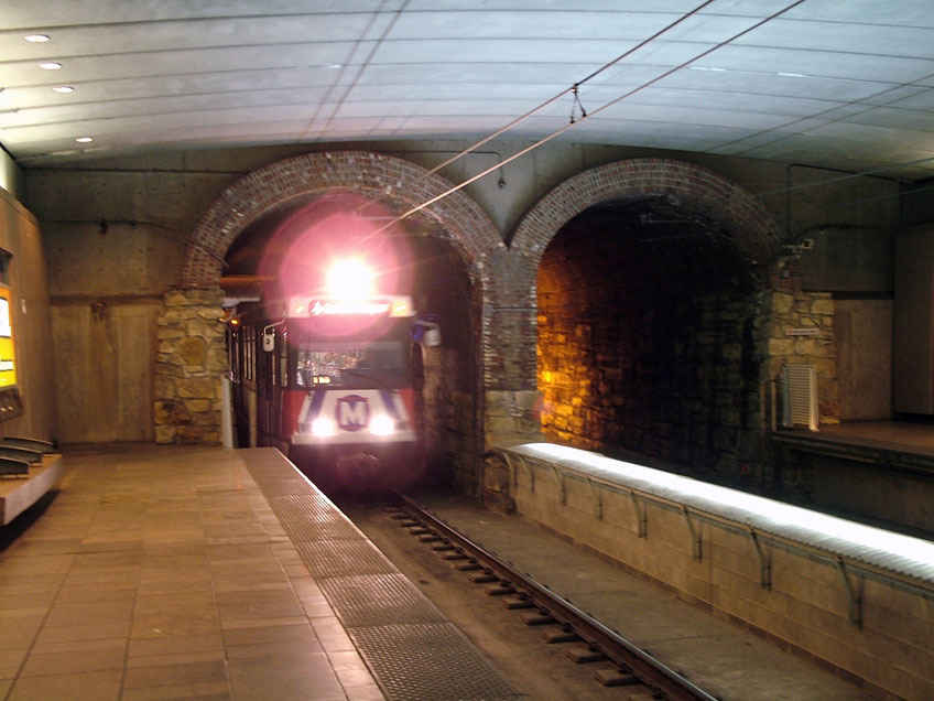
1-04. Eastbound two-car train barely fits into the underground Convention Center Station. The ever-present security guard on the westbound platform pretends to ignore the photographer. (19-June-2005, YM) |
|
1-04. The line goes through an abandoned freight railroad 1.8 mile tunnel beneath downtown St. Louis, which features an impressive arched roof visible at the mouths of the tunnel. Westbound train approaches the Convention Center Station. (19-June-2005, YM) |
|
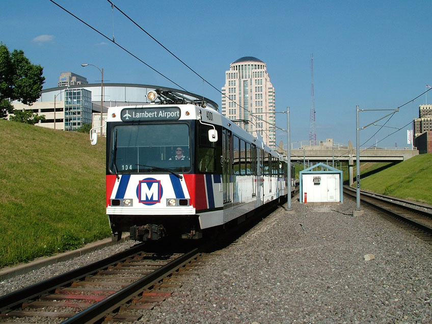
1-05. Eastbound train approaches the Union Station stop via completely segregated right-of-way south of downtown. This train consists of the newest Siemens-Duewag SD460 high-floor articulated cars of the 4000 series, cars 4001+4002. (19-June-2005, YM) |
|
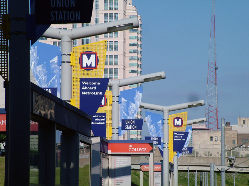
1-06. MetroLink logo and multiple 'Welcome Aboard MetroLink' signs at the Union Station stop. Note old 'To College' signs that in 2005 still don't recognize the latest extension to the Shiloh-Scott air-force base. (19-June-2005, YM) |
|
1-06. The Union Station stop at track level . (19-June-2005, YM) |
|
1-07. Eastbound train between the Central West End Station and the Grand Station on the right-of-way built just south of main passenger-generating corridors of Lindell Blvd and Delmar Blvd. Part of this section of the line is built along Missouri Pacific and Burlington Northern railroad corridor. (19-June-2005, YM) |
|
1-08. Westbound train at the Central West End Station. (19-June-2005, YM) |
|
1-09. Westbound train on the right-of-way built inside Forest Park. (19-June-2005, YM) |
|
1-10. After leaving the park, westbound train approaches the Forest Park Station. The city-bound track is dismantled in order to provide space for construction of the connection to the new Cross-County Extension. (19-June-2005, YM) |
|
1-10. The Forest Park Station. The new extension will branch off the existing line just west of this station. A short section within the station is temporarily operated via a single track. (19-June-2005, YM) |
|
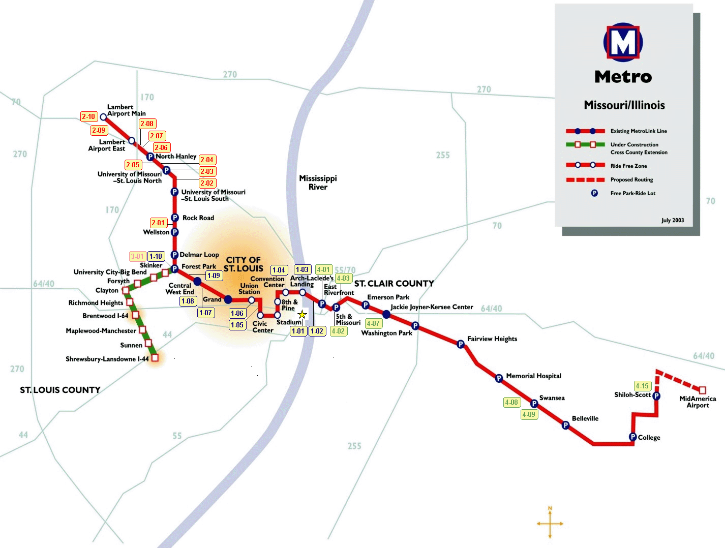
This graphic map is posted at most stations. The Lindell Blvd corridor, main attractions along Grand Blvd and the University City are still out of reach of the light rail. (19-June-2005, YM) |
|
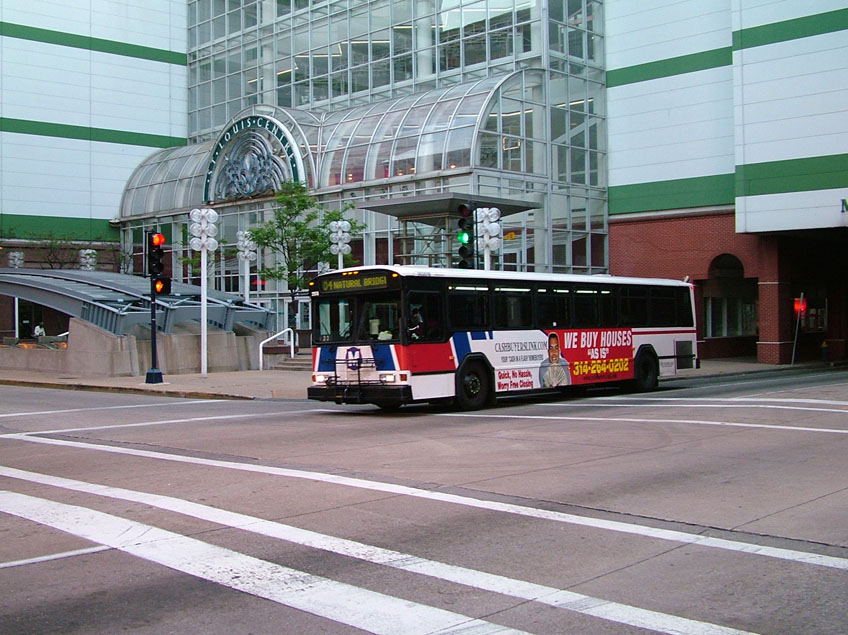
1-19. Metro bus in downtown St. Louis. While some lucky neighborhoods along the light rail line are enjoying a reliable and regularly scheduled public transit, city's buses do not provide nearly the same level of service. On a given Sunday the headway on the light rail line was standard 15 minutes. Main bus routes operated on the 2 hour (!) headway, including the main Market St - Lindell Blvd route. (19-June-2005, YM) |
© 2002 Author: Yury Maller
Content: Yury Maller, Stefan Mashkevich, Mike Glikin
Presentation: Stefan Mashkevich
Usage of material found herein is permitted provided the source is mentioned. Usage for public display is possible with authors' permission only.
Last update
10-Dec-2005